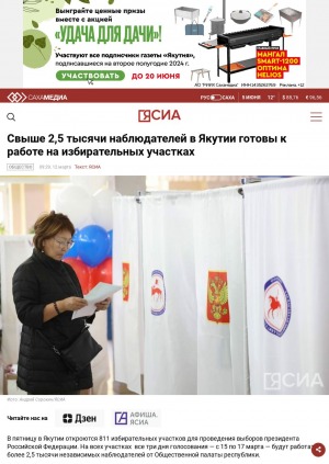
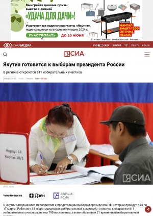
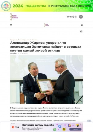
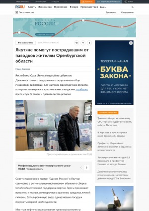
Год выпуска: 2024
Год выпуска: 2024
Год выпуска: 2023
Год выпуска: 2024
Год выпуска: 2024
Год выпуска: 2023
Количество страниц: 8 с.
- Математика. Естественные науки > Астрономия. Астрофизика. Исследование космического пространства. Геодезия,
- Прикладные науки. Медицина. Ветеринария. Техника. Сельское хозяйство > Управление предприятиями. Организация производства, торговли и транспорта,
- НАУКА ЯКУТИИ > ПРИКЛАДНЫЕ НАУКИ. МЕДИЦИНА. ТЕХНИКА. СЕЛЬСКОЕ ХОЗЯЙСТВО > Управление предприятиями. Организация производства, торговли и транспорта,
- НАУКА ЯКУТИИ > МАТЕМАТИКА. ЕСТЕСТВЕННЫЕ НАУКИ > Астрономия. Астрофизика. Исследование космического пространства. Геодезия.
A spatial analysis of intra-regional transport accessibility of settlements in the Arctic districts of the Sakha Republic (Yakutia) by GIS is an urgent task and can become a necessary support for the processes of decision-making and planning of sustainable development of these territories. The purpose of the study is to perform a spatial analysis of intra- regional transport accessibility of settlements in remote Arctic regions of Yakutia on the example of Anabarsky and Nizhnekolymsky districts. On the basis of the GIS network analysis and calculated coe cients of density of the transport network, the assessment of transport accessibility of the study areas according to winter and summer scenarios was carried out. The automobile and river networks were built on the basis of data from open cartographic sources: OpenStreetMaps and Google Earth Engine, the atlas of highways of the Sakha Republic (Yakutia). On the basis of satellite images of Landsat 5, 8 and Sentinel 2, non- o cial (informal) roads that play an important role in communications between settlements were decrypted and digitized. QGIS and ArcGIS programs were used to perform network analysis and build a map of time availability of the settlements using isochronous method. The created maps clearly show the availability of settlements by time interval. The conducted research made it possible to determine that remote sensing and geoinformation systems are key tools for a spatial analysis of transport infrastructure. Using this tools, it is possible to conduct network analysis of various levels of complexity, as well as build graphs of the transport network, greatly simplifying the counting procedure. The paper tested a method that allows to identify uno cial roads in the Arctic, and the presented methods of GIS analysis and modeling that can be used for further deeper network analytics and graph theory to improve the methodology for studying the transport accessibility of the Republic of Sakha (Yakutia).
Обутов, К. А. Пространственный анализ внутрирайонной транспортной доступности с использованием сетевого ГИС-анализа (на примере Анабарского и Нижнеколымского улусов) / К. А. Обутов, А. Н. Саввинова ; Северо-Восточный федеральный университет им. М. К. Аммосова // Вестник Северо-Восточного федерального университета им. М. К. Аммосова. Серия: Науки о земле. - 2023. - N 4 (32). - C. 111-118. - DOI: 10.25587/2587-8751-2023-4-111-118
DOI: 10.25587/2587-8751-2023-4-111-118

Год выпуска: 2022
Год выпуска: 2023
Количество страниц: 15 с.
The article reveals the activities of the Zolotinka geocryological station in South Yakutia, one of the BAM expeditions of the Institute of Permafrost, USSR Academy of Sciences. Relevance. The article is dedicated to the 95th anniversary of the birth of Maria Gavrilova, a climatologist, permafrost scientist, famous in Russian and world science, Doctor of Geographical Sciences, professor, Honored Scientist of the Russian Federation and the Republic of Sakha (Yakutia), academician of the Academy of Sciences of the Republic of Sakha (Yakutia), the Russian Academy of Natural Sciences [1]. The BAM expeditions of the Institute of Permafrost were united by a common research topic “Prediction of the evolution of the cryolithozone in the development of the territory adjacent to the BAM railway” to predict the state of geocryological conditions and make practical recommendations for the construction of engineering structures in settlements, stations and roads in the Maly BAM zone [2]. In di erent natural conditions, landscapes of the foothills of the Stanovoi Ridge of South Yakutia (valleys, watersheds, as well as on the slopes of di erent exposures), special permafrost conditions are formed associated with the patterns of heat exchange of the upper layers of the earth’s crust - the earth’s surface - the atmosphere [2]. To identify permafrost, microclimatic and thermal balance conditions in the midlands of South Yakutia, on the territory of the village of Iengra of the Neryungrinsky City Council, on September 1, 1975, the Zolotinka geocryological station was organized under the leadership of Dr. Gavrilova. The year-round station conducted three full cycles of microclimatic and thermal balance studies from 1975-1978. A retrospective approach to the topic of the BAM expedition organized by the Institute of Permafrost made it possible in this article to familiarize and summarize in detail the scienti c and organizational activities of Maria Gavrilova on the work of the Zolotinka geocryological station in 1975-1978.
Пахомова, Л. С. Микроклиматические и теплобалансовые исследования в природных условиях среднегорий Южной Якутии / Л. С. Пахомова ; Северо-Восточный федеральный университет им. М. К. Аммосова // Вестник Северо-Восточного федерального университета им. М. К. Аммосова. Серия "Науки о Земле". - 2024. - N 1 (33). - C. 88-102. - DOI: 10.25587/2587-8751-2024-1-88-102
DOI: 10.25587/2587-8751-2024-1-88-102