- Книга (3097)
- Газета (3)
- Журнал (22)
- Автореферат диссертации (181)
- Изоиздание (8)
- Аудиоиздание (4)
- Видеоиздание (187)
- Картографическое издание (17)
- Неопубликованный документ (15)
- Нотное издание (1)
- Фотография (14)
- Статья (768)
- Библиографический указатель (204)
- Словарь (6)
- Календарь (4)
- Брошюра (68)
- Буклет (22)
- Игра (1)
- Веб-архив (160)
- Не указан (2)
- Литературно-художественные издания (285)
- Официальные издания (117)
- Научные издания (1333)
- Научно-популярные издания (1946)
- Информационные издания (531)
- Справочные издания (79)
- Учебные издания (126)
- Производственно-практические издания (3)
- Массово-политические издания (348)
- Изобразительное издание (12)
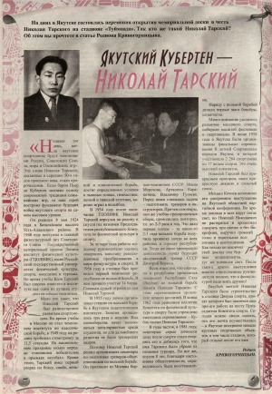
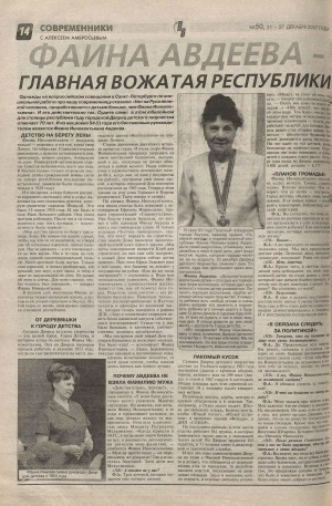
Источник: Юность Севера. - 2015. - 6 ноября. - С. 10
Количество страниц: 1 с.
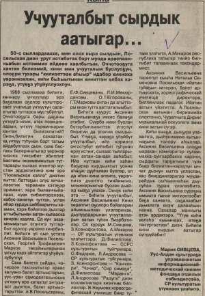
Источник: Саха сирэ. - 2007. - 2007. - Тохсунньу 10 к. - С. 4.
Количество страниц: 1 с.
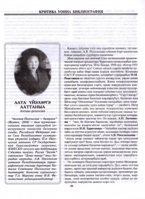
Источник: Чолбон. - 2005. - 2005. - N 6. - С. 89-95.
Количество страниц: 7 с.
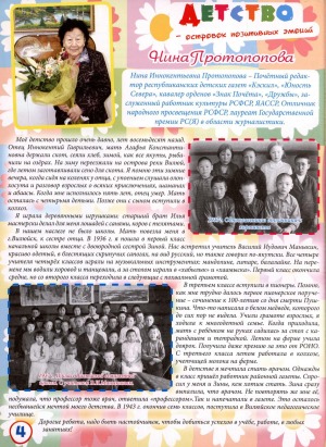
Источник: Колокольчик. - 2014. - N 6. - C. 4.
Количество страниц: 1 с.
Источник: Наше время. - 2007. - 21-27 декабря. - С. 14
Количество страниц: 1 с.
Источник: Школьная пора. - 2013. - N 4. - С. 32-33
Количество страниц: 2 с.
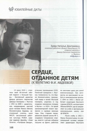
Источник: Дополнительное образование Якутии. - 2019. - N 5 (5). - С. 168-171
Количество страниц: 2 с.
Количество страниц: 9 с.
- Общий отдел > Информационные технологии. Вычислительная техника,
- Краеведение. Археология. География. Биографии. История > Общие вопросы. География как наука. Географические исследования,
- НАУКА ЯКУТИИ > ОБЩИЙ ОТДЕЛ > Информационные технологии. Вычислительная техника,
- НАУКА ЯКУТИИ > КРАЕВЕДЕНИЕ. ГЕОГРАФИЯ. БИОГРАФИИ. ИСТОРИЯ > Общие вопросы. География как наука. Географические исследования.
In this article the problem of studying the landscape structure of inaccessible territories is considered on the example of the neighbourhood of Lake Labynkyr in the Republic of Sakha (Yakutia). The characteristic features of the nature of the unique Lake Labynkyr are highlighted and described. From the position of landscape structure differentiation vegetation indices are analysed. The result of using NDVI (Normalised Difference Vegetation Index), TVI (Transformed Vegetation Index), NRVI (Normalised Ratio Vegetation Index), MTVI2 (Modified Triangular Vegetation Index - improved), MSAVI2 (Modified Soil Corrected Vegetation Index - 2) is presented. The methodology used is based on the experience of studies of areas of similar inaccessibility and uses the raster calculator of QGIS software in combination with slope steepness data obtained from the digital model. Particular attention is paid to the features of the relief, as it is one of the leading factors in the formation of the type of terrain. Characteristic features of five terrain types of the study area are identified and described: slope deluvial-solifluctional, slope deluvial-colluvial, moraine (foothill moraine), mountain-valley, glacial-valley. Based on the analysis of the collected field material, as well as the use of remote sensing methods and geoinformation technologies, the spatial organisation of landscapes was revealed and a map scheme was presented.
Обутов, К. А. Изучение ландшафтной структуры труднодоступных территорий с применением ГИС-технологий (на примере озера Лабынкыр) / Обутов К. А., Дегтева Ж. Ф., Данилов Ю. Г. ; Северо-Восточный федеральный университет им. М. К. Аммосова // Успехи современного естествознания. - 2023. - N 12. - С. 146-154. - DOI: 10.17513/use.38185
DOI: 10.17513/use.38185
Количество страниц: 6 с.
- Краеведение. Археология. География. Биографии. История > Общие вопросы. География как наука. Географические исследования,
- Математика. Естественные науки > Природа. Охрана окружающей среды,
- НАУКА ЯКУТИИ > МАТЕМАТИКА. ЕСТЕСТВЕННЫЕ НАУКИ > Природа. Охрана окружающей среды,
- НАУКА ЯКУТИИ > КРАЕВЕДЕНИЕ. ГЕОГРАФИЯ. БИОГРАФИИ. ИСТОРИЯ > Общие вопросы. География как наука. Географические исследования.
The article considers an ecological and geographical assessment of the stability of landscapes of specially protected natural areas on the example of the Kuoluma-Chappanda resource reserve of the Tattinsky ulus of the Republic of Sakha (Yakutia). For the first time in the reserve business, a methodology was proposed for assessing landscape criteria according to a point system - according to geographic accessibility in kilometers of protected areas, according to the duration of the frost-free period - the main factor in landscape productivity, according to the forest cover of protected areas - the main factor in the reproduction of wild animals, according to the area of protected areas in square kilometers. Further, according to the table, points of protected areas are set and, according to their results, they are classified into the following classes of sustainability of landscapes of protected areas: class 1 - ecologically highly stable landscapes of protected areas; Class 2 - ecologically sustainable landscapes of protected areas; 3rd class - ecologically medium-stable landscapes of protected areas; Class 4 - ecologically unstable landscapes of protected areas; Class 5 - ecologically prone landscapes of protected areas. The resource reserve is located in the Aldan-Amga interfluve. The climate is sharply continental with severe winters and warm summers. The taiga vegetation is represented mainly by lichen-lingonberry-ledum larch forest. The growing season is short. According to the results of the assessment of the sustainability of landscapes of protected areas, the Kuoluma-Chappanda resource reserve has the following data. The total score of the resource reserve is 14 points and belongs to the ecologically moderately stable landscapes of protected areas. According to the assessment, the reserve is of medium size and is located quite close to settlements, which can be used in the development of tourism. In terms of forest cover, the reserve belongs to continuous forest areas. In terms of the duration of the frost-free period, the territory of the reserve is less than average, as well as throughout the entire part of Central Yakutia. In terms of geographic accessibility, it belongs to medium accessibility.
Николаев, А. А. Эколого-географическая оценка устойчивости ландшафтов особо охраняемых природных территорий на примере ресурсного резервата "Куолума-Чаппанда" / Николаев А. А. ; Северо-Восточный федеральный университет им. М. К. Аммосова // Успехи современного естествознания. - 2023. - N 11. - С. 89-94. - DOI: 10.17513/use.38148
DOI: 10.17513/use.38148