Количество страниц: 3 с.
- Общественные науки. Образование > Народное образование. Воспитание. Обучение. Организация досуга > Общеобразовательная школа. Дошкольные учреждения,
- Математика. Естественные науки > Физика,
- НАУКА ЯКУТИИ > ОБЩЕСТВЕННЫЕ НАУКИ > Народное образование. Воспитание. Обучение. Организация досуга > Общеобразовательная школа. Дошкольные учреждения,
- НАУКА ЯКУТИИ > МАТЕМАТИКА. ЕСТЕСТВЕННЫЕ НАУКИ > Физика.
Алексеева, Т. Н. Постановка образовательных целей для активизации слабомотивированных обучающихся: теория-практика-функциональность / Т. Н. Алексеева ; МБОУ "Югюлятская средняя общеобразовательная школа им. И. В. Яковлева" // Народное образование Якутии. - 2023. - N 1 (126). - С. 37-39.
Количество страниц: 2 с.
- Математика. Естественные науки,
- Общественные науки. Образование > Народное образование. Воспитание. Обучение. Организация досуга > Общеобразовательная школа. Дошкольные учреждения,
- НАУКА ЯКУТИИ > ОБЩЕСТВЕННЫЕ НАУКИ > Народное образование. Воспитание. Обучение. Организация досуга > Общеобразовательная школа. Дошкольные учреждения,
- НАУКА ЯКУТИИ > МАТЕМАТИКА. ЕСТЕСТВЕННЫЕ НАУКИ.
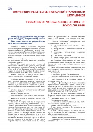
The article describes the program ofextracurricular activities "Alaas ogotobun", developed bythe methodological association of teachers of the naturalscience cycle of the Tyungyulyun secondary school. Theprogram is aimed at the formation of natural scienceliteracy through the study of the alaas biogeocenosis.
Баишева, Л. А. Формирование естественнонаучной грамотности школьников / Л. А. Баишева ; МБОУ "Тюнгюлюнская средняя общеобразовательная школа им. А. С. Шахурдина с углубленным изучением отдельных предметов" // Народное образование Якутии. - 2023. - N 2 (127). - С. 16-17.
Количество страниц: 10 с.
- Общественные науки. Образование > Экономика. Экономические науки. Политическая экономия > Экономические науки в целом. Политическая экономия,
- Математика. Естественные науки > Природа. Охрана окружающей среды,
- НАУКА ЯКУТИИ > ОБЩЕСТВЕННЫЕ НАУКИ > Экономика. Экономические науки. Политическая экономия,
- НАУКА ЯКУТИИ > МАТЕМАТИКА. ЕСТЕСТВЕННЫЕ НАУКИ > Природа. Охрана окружающей среды.
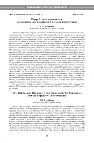
Гренадерова, М. В. Esg-рейтинги и рэнкинги: их значение для компаний и региона присутствия / М. В. Гренадерова ; Северо-Восточный федеральный университет им. М. К. Аммосова // Вестник Северо-Восточного федерального университета им. М. К. Аммосова. Серия: "Экономика. Социология. Культурология". - 2023. - N 4 (32). - C. 69-78. - DOI: 10.25587/2587-8778-2023-4-69-78
DOI: 10.25587/2587-8778-2023-4-69-78
Количество страниц: 2 с.
Данилов, Н. Н. Всесоюзная школа "Оптимальное управление. Геометрия и анализ" / Н. Н. Данилов, Н. Н. Козик, Н. К. Смоленцев // Успехи математических наук. - 1989. - Т. 44, Вып. 3. - С. 199-200.
Количество страниц: 8 с.
- Общественные науки. Образование > Право. Юридические науки > Государственное право. Конституционное право. Административное право,
- Математика. Естественные науки > Общая геология . Метеорология. Климатология. Историческая геология. Стратиграфия. Палеогеография,
- НАУКА ЯКУТИИ > ОБЩЕСТВЕННЫЕ НАУКИ > Право. Юридические науки,
- НАУКА ЯКУТИИ > МАТЕМАТИКА. ЕСТЕСТВЕННЫЕ НАУКИ > Геология. Геологические и геофизические науки.
Яковлева, Т. А. Правовое регулирование охраны морской среды приосвоении недр в арктической зоне России (окончание) / Т. А. Яковлева ; Северо-Восточный федеральный университет им. М. К. Аммосова, Юридический факультет // Вестник Северо-Восточного федерального университета им. М. К. Аммосова. Серия: История. Политология. Право. - 2023. - N 3 (31). - C. 43-50. - DOI: 10.25587/2587-5612-2023-3-43-50
DOI: 10.25587/2587-5612-2023-3-43-50

Количество страниц: 9 с.
The accuracy of GHCN-CAMS reanalysis reproduction of the intra-annual air temperature distribution was assessed for the historical (1961-1990) and current (1991-2020) climatic periods, on the scale of climatic norms of seasons and individual months. Data on 86 meteorological stations on the territory of the Sakha Republic (Yakutia), for which climatic series in both time periods were available, were used. The climatic norms of meteorological stations for both periods, as well as their change between periods, were compared with the GHCN- CAMS reanalysis data in corresponding pixels. The root mean square error, Pearson correlation coe cient, and Lin’s concordance coe cient were calculated as similarity metrics. Climatic norms for meteorological stations and calculated in the GHCN-CAMS reanalysis model are closely related linearly, with a correlation coe cient above 0.9, and the highest accuracy is observed for spring months. At the same time, the quality of reanalysis reconstruction of change in climatic norms for months and seasons between periods is signi cantly lower; the best reanalysis accuracy is for fall and winter, and signi cantly lower for summer. In general, the GHCN-CAMS model can be used for calculation and forecasting applications that require intra-annual air temperature distribution.
Тананаев, Н. И. Оценка точности реанализа GHCN-CAMS в расчетах внутригодового распределения температуры воздуха на территории Республики Саха (Якутия) / Н. И. Тананаев, М. А. Тимофеев ; Северо-Восточный федеральный университет им. М. К. Аммосова, Институт мерзлотоведения им. П. И. Мельникова // Вестник Северо-Восточного федерального университета им. М. К. Аммосова. Серия: Науки о земле. - 2023. - N 4 (32). - C. 99-110. - DOI: 10.25587/2587-8751-2023-4-99-110
DOI: 10.25587/2587-8751-2023-4-99-110
Количество страниц: 20 с.
- Математика. Естественные науки > Общая биология. Антропология. Вирусология. Микробиология,
- Математика. Естественные науки > Природа. Охрана окружающей среды,
- НАУКА ЯКУТИИ > МАТЕМАТИКА. ЕСТЕСТВЕННЫЕ НАУКИ > Природа. Охрана окружающей среды,
- НАУКА ЯКУТИИ > МАТЕМАТИКА. ЕСТЕСТВЕННЫЕ НАУКИ > Общая биология. Антропология. Вирусология. Микробиология.
For the purposes of monitoring the state of forest ecosystems, it is most e ective to use the capabilities of remote methods. On multispectral Landsat satellite images (a time series of summer and autumn images for 2000, 2001, 2013, 2014) of the territory of the Olekminsky State Nature Reserve, fragments of forests 2 dominated by Gmelin larch (Larix gmelinii Rupr.) with an area of 250 km (scale 1:5000). Then the polygons were saved at three levels of segmentation (scaling) - 4, 16, 64 with scales of 1:2500, 1:1250, 1:625. During decryption, uncontrolled classi cation of polygons using the ISODATA (Iterative Self-Organizing Data Analysis Technigue) method into 2,4,10 classes was carried out. Classi cation into two classes was used to calculate the forest cover index. Seasonal changes were determined by the di erence in the forest cover index values of the polygons in summer and autumn. It has been shown that the greater the di erence, the greater the proportion of larch in mixed forest stands. Distribution curves of forest cover index values were constructed for polygons of the 3rd scaling level. Based on the results of classi cation into 4, 10 classes, statistical processing was carried out with the calculation of indicators of di erence and similarity of polygons - dispersion of the general population and Fisher’s test (F-test). The results of changes in population dispersion and F-test at di erent levels of segmentation and in di erent years are considered.
Рожков, Ю. Ф. Оценка сезонных изменений лесов с использованием сегментации и кластерного анализа космических снимков landsat / Ю. Ф. Рожков, М. Ю. Кондакова ; Государственный заповедник "Олекминский", Гидрохимический институт г. Ростов-на-Дону // Вестник Северо-Восточного федерального университета им. М. К. Аммосова. Серия: Науки о земле. - 2023. - N 4 (32). - C. 79-98. - DOI: 10.25587/2587-8751-2023-4-79-98
DOI: 10.25587/2587-8751-2023-4-79-98
Количество страниц: 10 с.
Investigations over the last decades have shown that Yakutia is not only a highly representative area for the study of global climate patterns, it is a model of the Earth due to the extensive in uence of the Siberian anticyclone. Covering a grid of coordinates from the Arctic and Paci c Oceans almost to the Atlantic and Tibet, Yakutia dictates the patterns of climate change for the entire Northern Hemisphere. That can be clearly seen on example of modern climate change. The rate of warming here outpaces the rate of the Earth warming in 3-5 average annual degrees, thus showing not only the current warming trend, but also predicting it for the entire Earth with further temperature rise in future. Our paper shows the course of climate change over the last three centuries. It relies on the global patterns of atmospheric circulation on the wave of the hundred-year rhythm. Their essence is that the middle of centuries always brings cooling associated with latitudinal circulation of the atmosphere, and the turn of the century - the warming, in which latitudinal circulation is replaced by meridian circulation. It was happening in the last three centuries, con rmed by instrumental observations, and so it was in the time of Columbus and Vikings. Both came to America at the turn of the century 500 and 1000 years ago, when the Arctic Ocean and the North Atlantic were ice-free.
Поморцев, О. А. Якутия - модель глобального потепления климата земли (на примере циркуляции атмосферы) / О. А. Поморцев ; Северо-Восточный федеральный университет им. М. К. Аммосова // Вестник Северо-Восточного федерального университета им. М. К. Аммосова. Серия: Науки о земле. - 2023. - N 4 (32). - C. 69-78. - DOI: 10.25587/2587-8751-2023-4-69-78
DOI: 10.25587/2587-8751-2023-4-69-78
Количество страниц: 9 с.
- Математика. Естественные науки > Геология. Геологические и геофизические науки,
- Краеведение. Археология. География. Биографии. История > Общие вопросы. География как наука. Географические исследования,
- НАУКА ЯКУТИИ > МАТЕМАТИКА. ЕСТЕСТВЕННЫЕ НАУКИ > Геология. Геологические и геофизические науки,
- НАУКА ЯКУТИИ > КРАЕВЕДЕНИЕ. ГЕОГРАФИЯ. БИОГРАФИИ. ИСТОРИЯ > Общие вопросы. География как наука. Географические исследования.
Presently, the climate is warming, with average annual temperatures rising every year, and theArctic remaining one of the most vulnerable regions. This has a noticeable e ect on the northern forests, which leads to the displacement of the tundra zone. Assessing the consequences of a projected increase in air temperature under climate change conditions requires spatial and instant monitoring of hard-to-reach areas. In the last few years, the use of remote sensing techniques and combinations of satellite imagery to calculate vegetation indices has generated great interest in obtaining high-de nition ground data. The article presents the results of modeling soil moisture in Anabar tundra, which is located in the north-west of Yakutia. The study was conducted on the border of tundra and forest tundra in three reference areas (tundra, tundra young forest, tundra indigenous forest). The simulation is presented by comparing the eld data and the normalized di erence index of humidity NDMI. The NDMI index uses the NIR and SWIR channels, calculates a multi-channel raster object and creates a raster image with index values from -1 to 1, which show the humidity level with a spatial resolution of 10 meters. The data showed that the value of humidity pixels according to NDMI in the tundra zone is 0.04, in the tundra young forest is 0.09 and, in the tundra, native forest is 0.15. It was found that the index data correlated with eld humidity data obtained from a depth of 0.2 m. A comparison of remote sensing decryption data with eld data made it possible to simulate the spatial distribution of soil moisture over the vast study area by extrapolation.
Никифорова, Н. Н. Моделирование весовой влажности грунтов на территории Анабарской тундры с использованием наземных исследований и данных дистанционного зондирования земли / Н. Н. Никифорова, С. В. Калиничева, А. Н. Федоров ; Институт мерзлотоведения им. П. И. Мельникова // Вестник Северо-Восточного федерального университета им. М. К. Аммосова. Серия: Науки о земле. - 2023. - N 4 (32). - C. 60-68. - DOI: 10.25587/2587-8751-2023-4-60-68
DOI: 10.25587/2587-8751-2023-4-60-68
Количество страниц: 9 с.
The article considers the features of the petrographic composition of the lamprophyre dyke, attributed to the kHunkhadi complex of Late Cretaceous age, established on the Endegechchu hill in the Yano-Adycha tin ore region located in the Adycha tectonic zone. The rocks have a porphyry structure, and mineral formations of their own magmatic stage, magmatic, metasomatic and late hydrothermal-metasomatic substitutions are isolated in their composition. Acharacteristic feature of these rocks are spherulites of concentric-zonal structure, covered with a shell of scaly or lamellar graphite, depending on the size of the spherulites, evenly distributed throughout the rock, which were studied for the rst time and have not been established in other igneous rocks widely developed in the area. The study of spherulites is an important petrological task, which makes it possible to identify the mechanisms of their formation and causes, can indicate the conditions of formation and sources of matter of the rocks containing them. The morphology of graphite, its distribution and the nature of its relationship with surrounding minerals are also very informative for establishing the primary nature of graphite and epigenetic changes in host rocks as a result of various hydrothermal-metasomatic processes, which is possible due to the ability of carbonaceous matter to redistribute in the rock when exposed to various forces, rather than being removed from it.
Шепелева, Я. П. Петрография лампрофиров Ендегеччюйской площади Яна-Адычанского оловорудного района / Я. П. Шепелева, С. В. Горский ; Северо-Восточный федеральный университет им. М. К. Аммосова // Вестник Северо-Восточного федерального университета им. М. К. Аммосова. Серия: Науки о земле. - 2023. - N 4 (32). - C. 42-50. - DOI: 10.25587/2587-8751-2023-4-42-50
DOI: 10.25587/2587-8751-2023-4-42-50